Rain Watch for June 27 to July 3: Monsoon picks pace, low water level risky
Rainfall has covered the country six days in advance this monsoon, but depleting water reservoir levels and a delay in the sowing of kharif crops are causes for concern
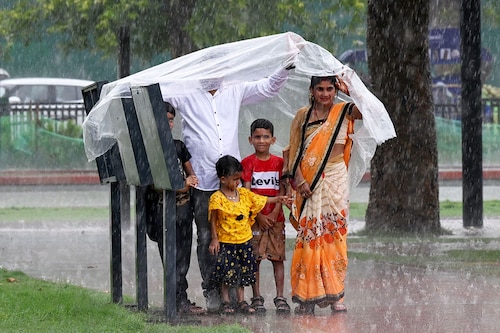
People enjoying rain at Kartavya Path on June 29, 2024 in New Delhi, India. Image: Sonu Mehta/Hindustan Times via Getty Images
Advertisement
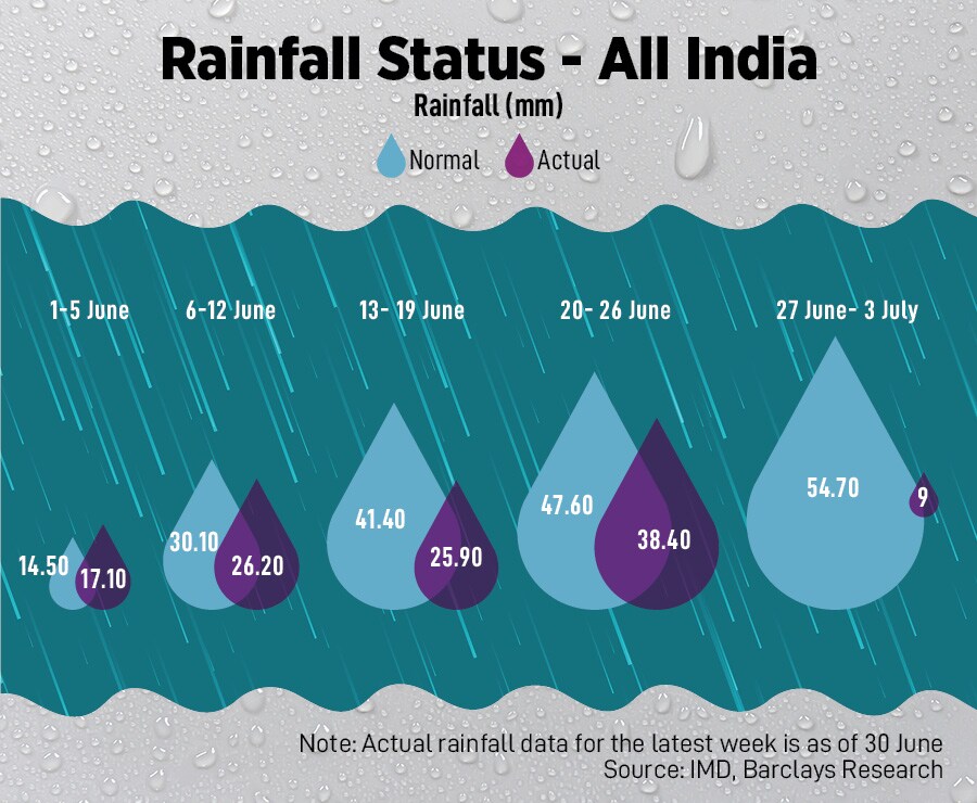
Even as overall rainfall is still below normal this monsoon, its intensity has picked up pace. In the last week of June, rainfall has covered almost entire country but continued low levels of water in reservoirs remain a concern.
As of June 30, rains were 11 percent below the long-period average (LPA) on a cumulative basis, based on Indian Meteorological Department (IMD) data analysis by Barclays. In the previous week ended June 23, rainfall deficit was at 18 percent.
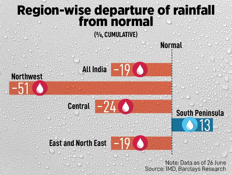
Region wise, northwest has a 51 percent deviation from normal rainfall, east and north east at 19 percent deficient rainfall while only southern peninsula has a surplus of 13 percent.
“The southwest monsoon has further advanced into remaining parts of Rajasthan, Haryana and Punjab," says IMD. Thus, it has covered the entire country on July 2 against the normal date of July 8, which is six days before the normal date of covering the entire India.
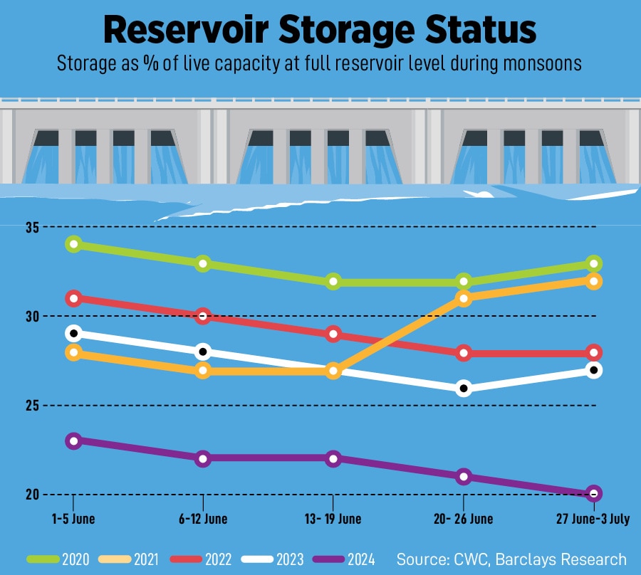
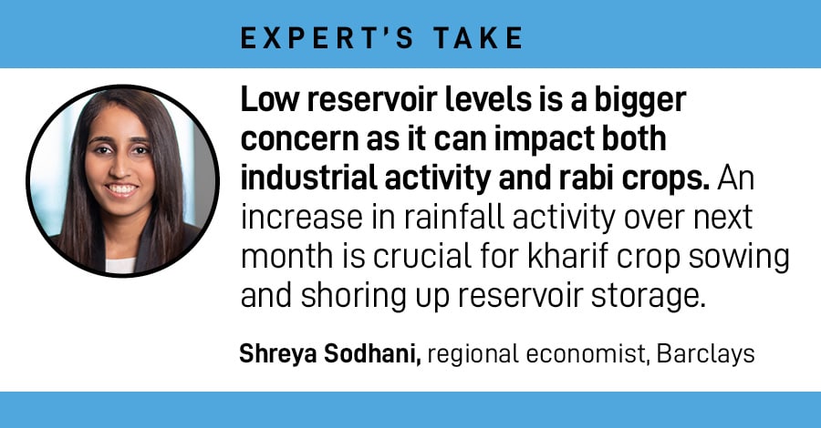
Trends in reservoir aren’t encouraging. Overall, basin-wise reservoir levels are in deficit, and below last year’s level.
Storage in 146 key reservoirs is at about 20 percent of total capacity, which is lower than 20 percent in previous week. This translates to 78 percent of the live storage of the corresponding period of last year and 85 percent of normal storage. Monsoon rains need to pick up significantly from current levels to replenish reservoirs, which are critical for the winter (rabi) crop.
Delayed rainfall has led to a late sowing of kharif crops, which may have an impact on already elevated food prices. Sufficient rainfall is critical in July as nearly 80 percent of sowing is completed in this month.
Overall, IMD forecasts monsoon to be at 106 percent of the LPA, indicating above normal rainfall in June to September period. “The strong El Nià±o conditions observed over equatorial Pacific in the beginning of this year have weakened rapidly into weak El Nià±o conditions and currently transitioning towards ENSO neutral conditions," IMD says.
The weather forecaster estimates La Nià±a conditions to likely to develop during later part of the monsoon season. El Nino is a naturally occurring climate pattern associated with warming of the ocean surface temperatures in the central and eastern tropical Pacific Ocean. It occurs on average every two to seven years, and episodes usually last nine to 12 months.
El Nià±o and La Nià±a are two opposing climate patterns that break normal conditions. During La Nià±a events, trade winds are even stronger than usual, pushing more warm water toward Asia.